GIS Done Differently Through Managed Geospatial Services™ (MGS)
SAM delivers MGS in a holistic manner that involves collecting, curating, cleaning, securing, storing, enriching, and maintaining an organization’s Geospatial data so the owners or stakeholders can then leverage the information to make informed business decisions. MGS solutions are made up of several components, among which are data collection, data prep, data pipelines, and data warehouses that enable better governance, improved architecture, and increased security of your assets. GIS is a major pillar in achieving optimum performance through Managed Geospatial Services™ throughout the infrastructure lifecycle.
There are many reasons why MGS is important to businesses and governments today. First and foremost, world-class Geospatial data management helps drive business value or reduces a government’s operating costs. It provides the foundation for businesses and governments to manage their digital information as a trustworthy asset that they can rely on for sound, value-based decision-making and change detection. World-class GIS enables an organization to scale as the volume and variety of the Geospatial data grow, which is estimated to increase by 20% annually. It will improve collaboration across the stakeholder ecosystem because everyone is working off the same version of truth.
Managed Geospatial Services™ provides the structure and support to enable stakeholders to focus on higher-value work. Instead of spending their days scrubbing mundane data problems, they can focus on strategic objectives, and analyzing results to support informed decisions that align to strategic objectives. Finding the right solutions for your organization is key. SAM’s subject matter experts will review your current practices and develop an MGS improvement plan that establishes a blueprint for a better future.
holistic (adjective)
characterized by the belief that the parts of something are interconnected and can be explained only by reference to the whole.
“The solution demands a holistic approach and a strategic vision of what can be achieved.”
GIS Solutions
GPS Data Collection
GPS Data Collection
Incorporate absolute accuracy with precise GPS locations for Utility and Transportation Infrastructure.
Inspection & Inventory
Inspection & Inventory
Establish a baseline for existing infrastructure for determining a value-based operational plan.
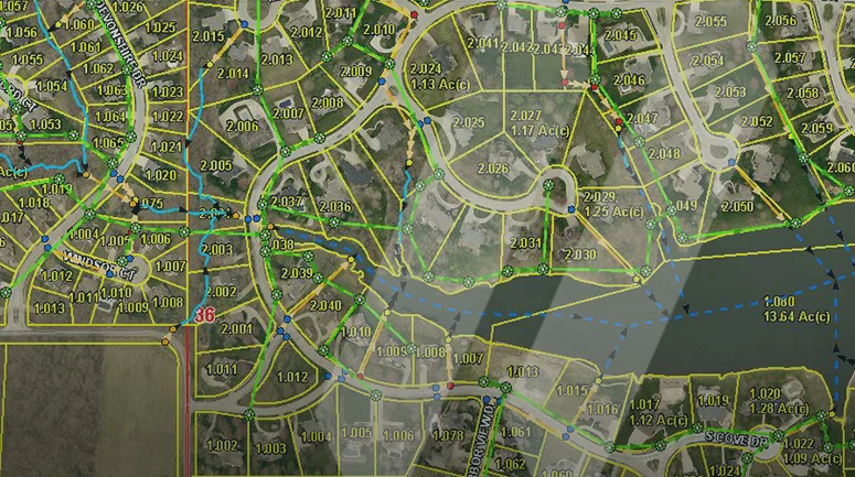
Mapping & Data Development
Mapping & Data Development
GIS enables better governance of infrastructure assets to achieve optimum performance.
GIS Web & Mobile Applications
GIS Web & Mobile Applications
Manage, edit, maintain, and analyze your GIS data with SAM Integrity™.
Maintenance & Support
Maintenance & Support
Collecting, curating, cleaning, securing, enriching, and managing your organization’s geospatial data.
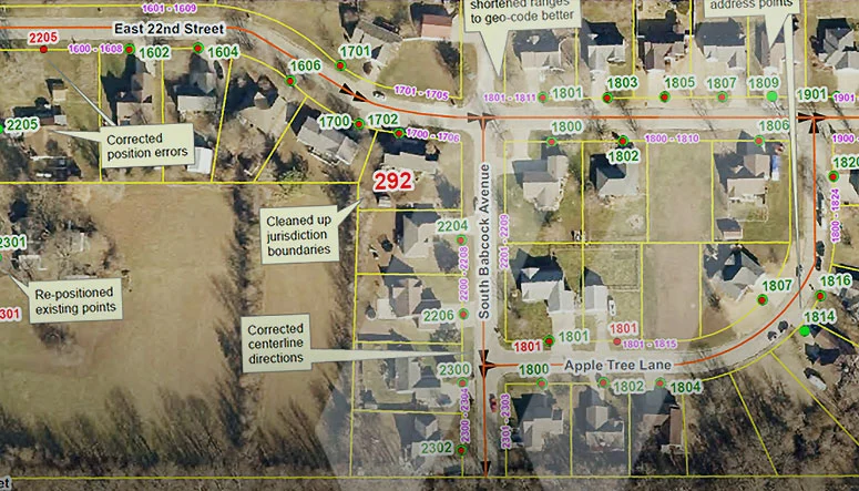
Secure GIS Data Management
Secure GIS Data Management
With SAM's secure GIS solutions, confidently manage infrastructure assets and drive actionable insights while protecting sensitive information through rigorous cybersecurity standards, access controls, and hardened IT infrastructure.
Leverage SAM’s expertise with Esri ArcGIS technology for robust, location-based analytics.
Who we serve
Government
Electric
Renewables
Water
Telecom-Fiber
Transportation
Natural Gas
Commercial
Industrial
Natural Resources
Why Sam?
SAM has built a reputation as a trusted, knowledgeable, and innovative partner.
SAM transforms petabytes of complex spatial data into intelligent insights in a holistic Managed Geospatial Services™ (MGS™) framework. MGS™ is the digital ecosystem that simplifies the complicated so our clients can achieve the impactful outcomes that drive their business forward.
As North America’s premiere MGS™ company, SAM provides practical, precise, and high-fidelity solutions designed to enhance decision-making, mitigate risks, achieve strategic objectives, and drive costs out of our client’s business. Our vision is to advance spatial data acquisition, improve analysis capabilities, and develop predictive analytics to redefine and transform how infrastructure assets are developed and managed throughout their lifecycles.
Our People
GIS integration is a major pillar in achieving optimum performance for managing infrastructure assets. SAM’s certified GIS Professionals (GISP) bring exceptional knowledge and innovation to develop a holistic framework for developing World-Class Managed Geospatial Services™.